
2:52
Introducing Gemini 2.0 | Our most capable AI model yet
Google · AI · Dec 2024
Google · Jan 2009 · 1:37 · AI-annotated
Google’s 1:37 launch film runs 35 scenes, about 2.8 s each. The product is on screen from the first frame and 6 features are revealed. The call to action lands at 1:27 (89% in), over a voiceover. The video is built as a title card, a fast three feature teaser montage, then a slow step by step screen recording of each feature, closing on a download card. Its style is defined by smooth 3D camera glides over the globe and terrain inside a fixed app frame, with cursor clicks marking each step.
Is this your launch? to your site or press kit.
Google · AI · Dec 2024
Spline · Design · Oct 2026
Spline · Design · Aug 2026
A plain white title card holds two centered lines of black sans-serif text above the multicolor Google logo. The frame stays locked and static for the full shot.
On-screen text: “What's New in Earth 5.0:”, “Historical Imagery, Ocean, Touring”
Camera: Static
The Google Earth app window fills the frame, the planet hanging in black space with North America centered, top toolbar and right-side tilt controls visible. The 3D camera pushes in from a full-globe view down to the curved atmospheric horizon over the continent. Faint stars dot the background and attribution lines sit at the bottom edge.
Techniques: UI zoom
Camera: Push in
A top toolbar and right-side control panel frame a 3D view of the Earth's surface seen from orbit. The camera glides across green and brown terrain beneath a glowing blue horizon and a black starfield, while attribution lines sit at the bottom center.
Camera: Push in
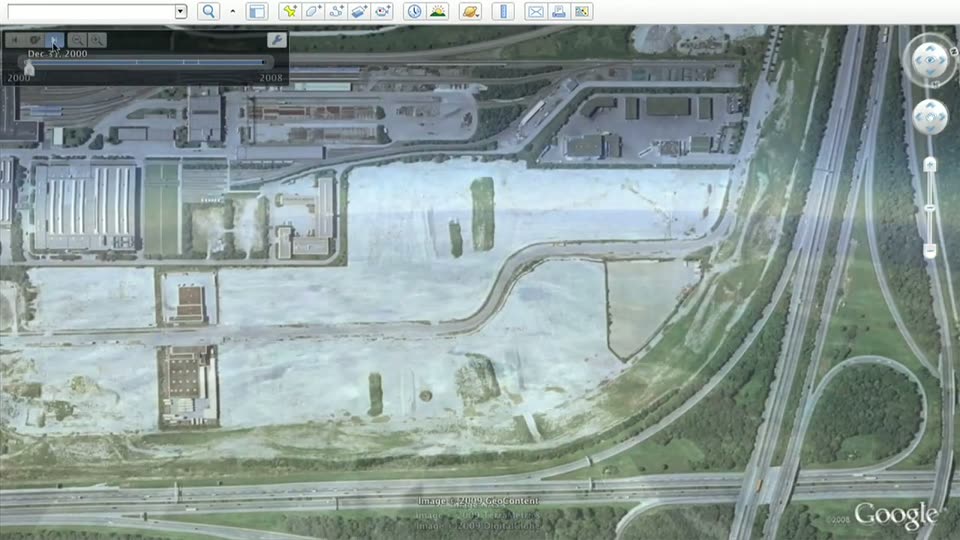
A top-down satellite map of an industrial zone fills the frame, with a toolbar of layer icons along the top and a time slider in the top-left showing Aug 29, 2004. A cursor rests on the slider's play button as the view holds still.
Techniques: Cursor demo
Camera: Static
A satellite view of a stadium under construction fills the frame in a locked-off shot. A timeline slider in the top-left corner advances, updating the date from Aug 29, 2004 to Apr 8, 2006, while a cursor hovers over the playback controls. The Google logo sits in the bottom-right corner.
Techniques: Cursor demo
Camera: Static
A Google Earth aerial view of a white-roofed stadium fills the frame. The time slider in the top left advances from 2006 to 2008, and the satellite imagery cross-dissolves from an AeroWest source to a DigitalGlobe source, with a cursor resting on the slider controls.
Techniques: Cursor demo
Camera: Static
A low 3D flyover of an ocean in Google Earth, the camera glides forward over rippling blue water toward a flat green headland on the horizon, framed by the app's top toolbar and right-side navigation controls.
Techniques: Parallax
Camera: Push in
A Google mapping interface shows an underwater 3D seafloor in blue and purple, with a flat teal water surface above. The view drifts slowly across the terrain while the top icon toolbar and the right-side compass and zoom slider stay fixed.
Techniques: 3D mockup
Camera: Static
A full-screen Google Earth view flies over a snow-capped mountain range in 3D, then swoops down into a valley to reveal an airport runway. A cursor moves from the top-right compass to the red record button at bottom-left.
Techniques: Cursor demo, Speed ramp
Camera: Push in
A full-screen Google Earth view shows a 3D mountain terrain under a pale blue sky, with a row of toolbar icons across the top. A white cursor moves to the clock icon and clicks it, turning the icon blue. The terrain holds still.
Techniques: Cursor demo
Camera: Static
A locked-off screen recording of Google Earth shows a 3D mountain valley with an airport runway. A cursor clicks the top toolbar and a Select date panel with a 1940 to 2008 slider opens in the top left corner.
Techniques: Cursor demo
Camera: Static
A Google Earth screen with a dark timeline panel over a hilly terrain view. The cursor pulls the slider handle left, and the tooltip above it flips from Select date to Nov 2006 while the 1940 and 2008 markers stay fixed.
Techniques: Cursor demo
Camera: Static
A dark timeline panel overlays a satellite terrain view, its blue slider marked 1940 to 2008. Two cursors drag the slider handle left as the date labels shift from Aug 1961 and Dec 2002 to Dec 1953 and Nov 2006, a yellow dot fixed at the right end.
Techniques: Cursor demo
Camera: Static
A grayscale satellite terrain fills the frame behind a dark timeline panel. A white arrow cursor drags the slider handle rightward as the date label shifts from Mar 1940 to May 1941.
Techniques: Cursor demo
Camera: Static
A grayscale 3D valley with an airport runway sits inside a mapping app window. A cursor drags the top-left timeline slider rightward, the date label stepping from 1971 to 1989 while the terrain stays locked off.
Techniques: Cursor demo
Camera: Static
A locked-off view of a Google Earth 3D terrain showing a mountain valley and an airport runway. A cursor drags the top-left timeline slider from 1989 toward 2005, the date label updating as the imagery shifts.
Techniques: Cursor demo
Camera: Static
A Google Earth window shows a 3D mountain valley with an airport runway, a time slider at the top left reads Sep 2006 with a cursor on the handle, and navigation controls sit at the right edge.
Techniques: 3D mockup, Cursor demo
Camera: Static
Screen capture of the Google Earth desktop app. A 3D globe of North America hangs in a starry black viewport while the left panel lists map layers. The cursor moves down and ticks the Ocean checkbox, highlighting the row.
On-screen text: “1940”, “2008”, “Image NASA”
Techniques: Cursor demo
Camera: Static
A 3D globe of Earth fills a black starfield inside the Google Earth window. A hand cursor drags the right-hand zoom slider, pulling the view from the whole planet down into the Mediterranean, where red-and-white markers and blue dots cluster over a bay with two white caption labels.
Techniques: Cursor demo, UI zoom
Camera: Push in
A Google Earth 3D view glides forward over a calm sea toward a mountain shoreline, the camera dipping just below the surface as white caption lines fade in and out over the water.
On-screen text: “The Silent World dazzles.”, “A month on the sea floor”, “Calypso serves science.”
Techniques: 3D mockup
Camera: Static
A Google Earth 3D view of a Mediterranean bay zooms in on a small Cousteau figure with a red hat floating on the water. The headline sits at the top right, then a dark blue info panel with the Cousteau logo and body copy pops in over the scene.
On-screen text: “The Silent World dazzles.”
Techniques: UI zoom, Cursor demo
Camera: Static
A Google Earth window over a 3D ocean view holds a dark blue Cousteau panel with logo, article text and a YouTube player. A cursor glides from the player's corner to the play button, and the blank player fills with a blue underwater clip.
Techniques: Cursor demo
Camera: Static
A Google Earth window shows a dark blue Cousteau layer panel over a coastal map. The left column holds the Cousteau logo and a paragraph on The Silent World; the right plays an embedded YouTube clip of torch-lit divers, the cursor clicking play then resting on the progress bar.
Techniques: Cursor demo
Camera: Static
A Google Earth interface fills the frame, a satellite ocean map behind a blue overlay panel. The panel shows a Cousteau logo, an article, and a YouTube player on the right with underwater footage. A red Join button sits below. The map stays static while the video plays.
Camera: Static
A 3D underwater view of a rippled sandy seafloor fills the frame beneath a Google Earth toolbar and a right-side compass and slider. The camera glides low across the terrain as the horizon drifts, with small attribution text fixed at the bottom.
Camera: Pan
A low camera flies across a 3D ocean inside the Google Earth window, the water shifting from a smooth haze to sharp ripples as a green coastline rises at the horizon. The toolbar and right-side navigation controls stay fixed in place.
Camera: Push in
The Google Earth view pulls up from a close pass over the sea surface to a high 3D vista of snow-capped peaks and green valleys, then holds still. A cursor drifts to the top toolbar as the voiceover introduces the Touring feature.
Techniques: Speed ramp, 3D mockup, Cursor demo
Camera: Pan
A white toolbar of small icons runs along the top of a blue gradient screen. A cursor glides to the camera icon and clicks it, and the button flashes blue to confirm recording has started.
Techniques: Cursor demo
Camera: Static
A locked-off view of the Google Earth window shows a 3D mountain range with snow-capped peaks on the right and green valleys on the left under a clear blue sky, framed by the app's top toolbar and side navigation controls.
Camera: Static
A satellite map of mountains fills the screen with a corner recording bar. A cursor clicks the red record button as the timer counts from 00:00 to 00:02. The view then opens into a 3D perspective of snow-capped peaks under a blue sky, with side navigation controls.
Techniques: Cursor demo
Camera: Static
A Google Earth window flies over a 3D mountain range, descending from a high horizon toward snow-capped peaks while green and brown valleys slide past. The toolbar, compass, zoom slider and Google mark stay fixed at the edges as the terrain closes in.
Camera: Push in
The Google Earth window fills the frame with a top-down 3D terrain view of a snow-capped mountain range. The camera pulls back across the ridges, then cuts to a tilted 3D perspective under a blue sky as a playback bar appears at the bottom left.
Techniques: UI zoom
Camera: Pull out
The Google Earth app window shows a 3D flythrough over snow-capped peaks and green valleys under a blue sky. The camera dollies forward across the terrain, then the headline Download Google Earth 5.0 fades in over the center as the view settles.
On-screen text: “Download Google Earth 5.0”
Camera: Push in
A hazy 3D mountain range fills the frame from a high vantage point. Centered dark gray text reads 'Download Google Earth 5.0' over a URL, with the multicolored Google logo beneath. The shot holds still as a closing call to action.
On-screen text: “Download Google Earth 5.0”, “http://earth.google.com”, “Google”
Camera: Static
A plain white card holds two centered lines of black text above the multicolored Google logo. The frame stays locked off for the full duration with no motion.
On-screen text: “Download Google Earth 5.0”, “http://earth.google.com”
Camera: Static