
0:20
Explore
New features in Google Earth 4.3
Google · Apr 2008 · 1:16 · AI-annotated
- Length
- 1:16
- Scenes
- 43 · 1.8 s avg
- Product on screen
- 0:00
- Features shown
- 9
- Call to action
- 1:11 · 94%
- Voiceover
- Yes
00:00:00 / 01:16:08
Google’s 1:16 launch film runs 43 scenes, about 1.8 s each. The product is on screen from the first frame and 9 features are revealed. The call to action lands at 1:11 (94% in), over a voiceover. The video is built as a continuous screen capture of the Google Earth desktop app, bookended by plain white logo cards, with a voiceover that names each feature just before the cursor demonstrates it on screen. Pacing is driven by fast space-to-street camera dives and hard cuts between UI panel close-ups and full 3D flyovers, with cursor drags on the zoom and time sliders used as the signature move to visibly change altitude and lighting.
No filming indicatedEstimated needs: 11 capture groups — your screens or recordings · 1 official logo — reused across the film · 9 3D passages — build or supply
Is this your launch? to your site or press kit.
More like this
0:45
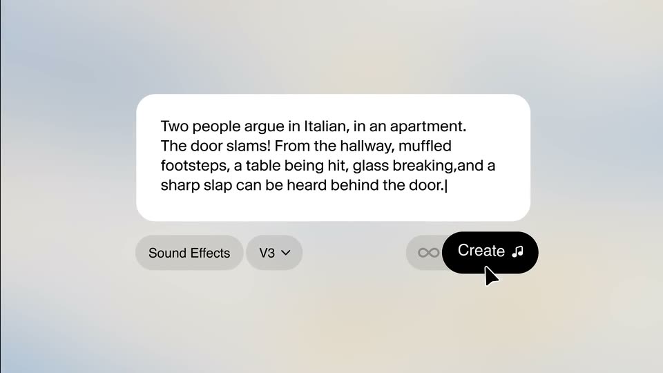

Introducing SFX v3
ElevenLabs · AI · Oct 2026
0:40


Topograph | The data layer for KYB
Topograph · Nov 2026
New features in Google Earth 4.3, scene by scene
· 43 scenes as text
01 · Product intro · 0:00–0:01
A plain white frame holds a centered black headline above the multicolor Google logo. Both elements stay static on a locked-off shot for the full duration.
On-screen text: “Explore new features in Google Earth.”
Camera: Static
02 · Product intro · 0:01–0:01
A Google Earth window fades in from white, a pale blue globe with North America centered behind a locked headline and the multicolor Google logo.
On-screen text: “Explore new features in Google Earth.”
Camera: Static
03 · Feature reveal · 0:01–0:04
A translucent blue globe with the Google wordmark and the caption “Explore new features in Google Earth.” fades into a satellite view of North America, then dives into San Francisco, where a cursor drags the zoom slider over 3D buildings.
On-screen text: “Explore new features in Google Earth.”, “Google”
Techniques: UI zoom, Cursor demo
Camera: Push in
04 · Feature reveal · 0:04–0:05
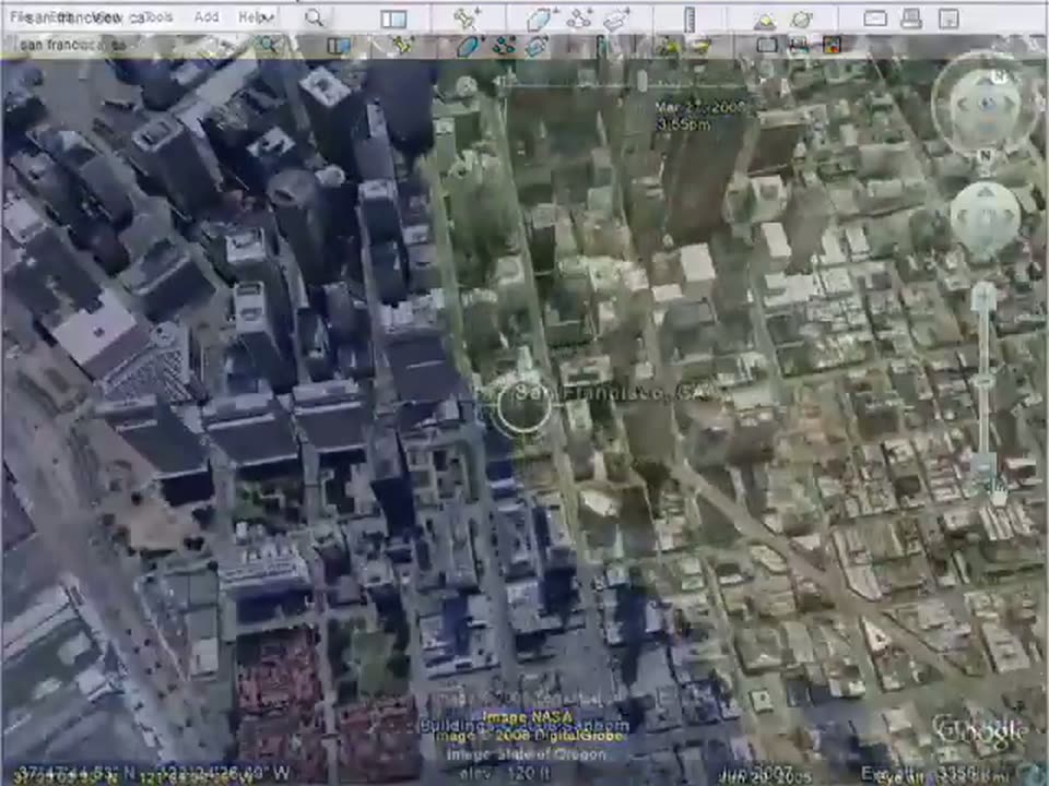
A 3D satellite view of San Francisco fills the screen as the camera pushes in over the buildings. A hand cursor sits on the vertical zoom slider at the right edge, with the toolbar and coordinate bar framing the Google Earth interface.
Techniques: 3D mockup, Cursor demo
Camera: Push in
05 · Feature reveal · 0:05–0:05
The Google Earth interface displays a 3D view of the San Francisco skyline, tilting upward to reveal the horizon and sky. A cursor hovers over the zoom slider on the right edge.
Techniques: Cursor demo
Camera: Static
06 · Feature reveal · 0:05–0:09
A full-screen Google Earth view shows a 3D San Francisco cityscape. A cursor drags the right-side zoom slider while the camera swoops from high altitude to street level, then rushes into a building facade with motion blur.
Techniques: Cursor demo, UI zoom
Camera: Static
07 · Feature reveal · 0:09–0:09
The camera sweeps fast along a low-poly 3D city street past white high-rise towers, edges motion-blurred, while two round navigation dials and a plus button stay fixed on the right edge.
Techniques: Parallax
Camera: Static
08 · Feature reveal · 0:09–0:10
A 3D perspective view of a city of pale high-rises shifts as a white hand cursor taps the circular look and pan controls stacked on the right edge.
Techniques: 3D mockup, Cursor demo, Parallax
Camera: Static
09 · Feature reveal · 0:10–0:11
A blocky 3D city skyline pans slowly under a blue sky. On the right edge, two circular D-pad controls with blue arrows and a hand icon, a plus zoom button and an N compass marker stay fixed in place.
Techniques: 3D mockup
Camera: Static
10 · Feature reveal · 0:11–0:11
A low-poly 3D city of white and grey towers sits under a clear blue sky, panning slowly left, while three circular navigation controls with blue arrows, an eye icon and a hand cursor float along the right edge.
Techniques: 3D mockup
Camera: Static
11 · Feature reveal · 0:11–0:12
A 3D city of white high-rise buildings fills the frame against a clear blue sky. Round navigation controls sit at the right edge, and the application menu bar fades in across the top.
Techniques: 3D mockup
Camera: Static
12 · Feature reveal · 0:12–0:16
The app's full window shows San Francisco City Hall's clock tower in 3D under a blue sky. A cursor drags the top time slider, and the timestamp runs from noon to early afternoon as the sun moves and the tower's faces fall into shadow.
Techniques: Cursor demo
Camera: Static
13 · Feature reveal · 0:16–0:17
A 3D dusk view of a clock tower fills the Google Earth window, a hand cursor on the timeline. The view zooms into the search panel as 'san' is typed into the field.
Techniques: UI zoom, Cursor demo
Camera: Static
14 · Feature reveal · 0:17–0:19
A close-up of a desktop search panel with the Fly To tab active. The text 'san francisco, ca' is typed letter by letter into the input field, a text caret blinking beside it, next to a dropdown arrow and a magnifying glass button.
Techniques: Cursor demo
Camera: Static
15 · Feature reveal · 0:19–0:20
A Google Earth window fills the frame. The left panel shows a Search box with 'san francisco, ca' typed and a Places list, a cursor resting below. The right side holds a satellite view of the San Francisco peninsula with a map label. The view is static.
Camera: Static
16 · Feature reveal · 0:20–0:24
A mouse cursor travels down the Layers list and clicks the 3D Buildings checkbox, turning it on, then the view switches to a 3D globe of North America under a top menu bar.
Techniques: Cursor demo
Camera: Static
17 · Feature reveal · 0:24–0:27
A desktop globe application opens on a 3D sphere tilted over the US West Coast. The view flies straight down, the sphere flattening into a top-down satellite map of San Francisco as the top timeline and bottom coordinate bar update.
Techniques: 3D mockup, UI zoom
Camera: Push in
18 · Feature reveal · 0:27–0:28
A flat satellite map of San Francisco tilts and zooms into a 3D perspective, extruding the city's buildings, while a white cursor rests on the altitude slider at the right edge.
Techniques: Cursor demo, UI zoom
Camera: Push in
19 · Feature reveal · 0:28–0:29
A 3D city map of San Francisco fills the screen inside a mapping interface. A hand cursor drags the zoom slider on the right as the view pulls back over the buildings.
Techniques: Cursor demo, UI zoom
Camera: Push in
20 · Feature reveal · 0:29–0:29
A high-angle 3D view of the San Francisco skyline fills the Google Earth window, framed by a top icon toolbar and a bottom data bar. The scene holds nearly still while a hand cursor hovers on the right-hand zoom slider.
Techniques: Cursor demo
Camera: Static
21 · Feature reveal · 0:29–0:35
The Google Earth desktop app shows a 3D aerial view of San Francisco. The camera orbits a gray tower on a hill while the mouse cursor drifts across the scene; the zoom slider sits at right and the left panel holds the typed city name.
Techniques: UI zoom, Cursor demo
Camera: Push in
22 · Feature reveal · 0:35–0:38
A flat screen capture of a 3D mapping app, with search and layers panels on the left, shows a white info card over a 3D city view. The card fades out as the 3D camera tilts to a closer overhead view of a plaza.
Techniques: UI zoom
Camera: Static
23 · Feature reveal · 0:38–0:42
A 3D city map tilts and swoops down from a high aerial view to street level as a hand cursor drags the zoom slider upward on the right. Directional and compass controls sit in the corners.
Techniques: Cursor demo, UI zoom
Camera: Push in
24 · Feature reveal · 0:42–0:45
A desktop map app shows a 3D city street. A cursor moves to the look joystick on the right and drags it, rotating the view around the buildings. The left panel lists search and layer options.
Techniques: Cursor demo
Camera: Static
25 · Feature reveal · 0:45–0:46
A low-resolution 3D city of grey high-rises pans right under a blue sky as two white circular control pads with blue arrows stay fixed at the right edge; a white hand cursor rests on the upper pad.
Techniques: Cursor demo
Camera: Static
26 · Feature reveal · 0:46–0:46
A low-angle 3D view of gray high-rise towers against a blue sky pans slowly to the left. On the right edge, two circular white joystick controls with blue arrows and hand icons sit stacked, with a small plus button on a stem below them.
Camera: Pan
27 · Feature reveal · 0:46–0:47
A 3D city of gray towers pans and tilts under a clear blue sky, the camera swinging left across the rooftops. Two glossy circular controls with hand and eye icons and blue arrows, plus a vertical slider, stay fixed on the right.
Techniques: 3D mockup
Camera: Static
28 · Feature reveal · 0:47–0:48
A 3D city under a deep blue sky, with two round joystick controls and a plus button stacked on the right edge. A white pointing-hand cursor presses the left arrow of the top joystick, and the view pans left to reveal low mountains on the horizon.
Techniques: Cursor demo
Camera: Static
29 · Feature reveal · 0:48–0:48
A gray building slides into view from the left against a blue sky, while two circular control pads remain fixed on the right. A white hand cursor points the left arrow on the upper eye joystick, suggesting a look-around action.
Techniques: Cursor demo
Camera: Pan
30 · Feature reveal · 0:48–0:50
The Google Earth window shows a 3D street-level view of a city block with a Macy's building under a blue sky. A hand cursor rests on the navigation joystick at the right while the view pans across the block, revealing neighboring buildings.
Techniques: Cursor demo
Camera: Static
31 · Feature reveal · 0:50–0:51
A mapping app window shows a 3D street view of a city, with a gray Macy's building on the right and a control panel on the left. A cursor drifts toward the round navigation joystick at the right edge.
Techniques: Cursor demo
Camera: Static
32 · Feature reveal · 0:51–0:51
A gray Macy's building fills the lower frame against a flat blue sky, overlaid with two circular joystick controls. A white hand cursor taps the right arrow of the lower pad and the view pans left.
Techniques: Cursor demo
Camera: Static
33 · Feature reveal · 0:51–0:53
A 3D city map pans left past a gray building marked macys under a flat blue sky. Two circular navigation controls with blue arrows sit on the right, an eye icon on the top and a hand icon on the lower move joystick, where a white hand cursor rests.
Techniques: Cursor demo, 3D mockup, Parallax
Camera: Static
34 · Feature reveal · 0:53–0:57
A 3D satellite map sweeps from the San Francisco coastline across rolling terrain, the camera diving over green plains and white Alpine ridges before settling on a Switzerland label. Map labels track the moving view.
Techniques: 3D mockup
Camera: Pull out
35 · Feature reveal · 0:57–0:58
A 3D relief map of the Alps pulls back, the white Switzerland label staying fixed above the peaks; a pixel-style toolbar with hand, sun, and mail icons appears along the top edge.
Techniques: 3D mockup, UI zoom
Camera: Push in
36 · Feature reveal · 0:58–1:03
A Google Earth horizon under a blue sky fills the frame. A hand cursor clicks the sun icon in the toolbar, opening a horizontal time slider. The cursor drags the handle left, and the sky fades to a starry night as the time readout updates.
Techniques: Cursor demo
Camera: Static
37 · Feature reveal · 1:03–1:03
A white hand cursor drags the timeline slider handle right, and the readout below updates from 12:05pm to 9:04pm on Mar 27, 2008. The dark satellite terrain below brightens as the time advances, while the icon toolbar stays fixed at the top.
Techniques: Cursor demo
Camera: Static
38 · Feature reveal · 1:03–1:04
A full Google Earth window shows snow-covered Swiss mountains in 3D. The top time slider moves, the clock ticks from 9:36 to 9:03 pm, and the sky glow and ridge lighting shift as the time changes.
Camera: Static
39 · Feature reveal · 1:04–1:05
The Google Earth window shows a 3D mountain terrain under a bright sun. The time slider at the top advances, shifting the sun and lighting across the ridges while the date and time readout updates.
Camera: Static
40 · Feature reveal · 1:05–1:06
The Google Earth app window fills the frame over a 3D ridge of mountains. The time slider at the top runs forward, the date and time readout ticking from 11:27pm to 12:57pm while the terrain holds steady.
Camera: Static
41 · Feature reveal · 1:06–1:11
Inside the Google Earth window, a 3D flyover of Swiss ridges plays as the top time slider scrubs from 11:03am toward dawn. The scene then fades and pulls back to the whole planet, Europe centered, against black space.
Camera: Pull out
42 · CTA · 1:11–1:12
The Google Earth window shows a 3D globe centered on Europe and Africa against black space, with the app menu and toolbar at top. The view pulls back from a close globe to a smaller centered globe as earth.google.com appears across it.
On-screen text: “earth.google.com”
Techniques: UI zoom
Camera: Pull out
43 · Outro · 1:12–1:16
The gray Google Earth globe and interface chrome fade out, leaving the black earth.google.com URL above the multicolor Google wordmark, centered on a plain white background in a locked-off frame.
On-screen text: “earth.google.com”
Camera: Static